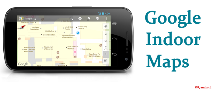
Since from the inception of Google, this search engine giant continuously enhancing its technologies to give comfortable browsing to all web users worldwide. So as a part of this process Google recently launched “indoor maps” in India which will helps users to browse via specific locations inside venues such as entertainment hubs,malls,museums and many more. This service is a part of Google maps which is already launched in 19 countries such as US,Canada,Germany,Japan,Hongkong,Netherlands and many more.
But in India 22 Indian cities(including metro cities) is being covered in initial stage for indoor maps like Delhi National Capital Region,Mumbai,Chennai,Pune,Hyderabad,Kolkata,Coimbatore and Hyderabad. Apart from the metro cities indoor maps would cover locations in cities such as Bhopal,Jaipur,Kochi,Chandigarh,Lucknow,Ludhiana,Moradabad and Dehradun.
Note: Android and iOS users can also download indoor maps application from apps store to browse its functionalities.
What is Indoor Maps
As this is a new service from Google so we must know its working and advantages. Indoor Maps is a part of Google Maps and anybody can access detailed floor plans of venues with just few swipes. Google also stated that, In some locations users will have the option of using the indoor My Location feature to help him/her navigate their way inside.
How Indoor Maps works
Indoor maps works just like searching any location in Google maps but with indoor maps we need to search for an available indoor maps location. After finding location, we need to follow two steps to experience indoor maps such as:
- First Zoom into the map until you start to see an indoor floor plan of building,mall,museums.
- Use the level switcher to move from the ground floor to other available floors in the building.
The map will show defined places in the building according to the data available in the system. Then after that user can touch any indoor location to experience more views.
Note: Users need to fully zoomed into a building where an indoor map is available to see desired search results.
How to upload a floor plan
- First save floor plan of the public location in your computer as a jpeg,tif,pdf,gif file. (Acceptable formats are .GIF, .TIF, .JPG, .PNG, .BMP, .PDF).
- Now go to the http://maps.google.com/help/maps/floorplans/ and click on “Add a floor plan now“.
- After step 2 you need to enter the desired building address to add the floor plan and then search.
- Now drag the balloon like image to the center of the building. By default this balloon like image is located at the street address, which sometimes doesn’t match the actual location of the building.
- After completing 4th step you need to enter more information about your floor plan such as building name,floor label,floor number and floor plan file. Just fill all the information by attaching saved image file from your computer and upload accordingly.
Align your floorplan with the aerial image of the building
- Choose notable features of your floor plan. Notable features may include corners or special shapes.
- Look for the features you just chose in the aerial view, and try to match them as best you can. Be sure to match each pin to the right feature and click OK. You can always go back and change the features you selected if this helps.
- You’ll see your floor plan overlaid on the aerial view. If it does not look the way you want, you can nudge it by moving the pins. Click Accept once you’re done. Before you submit the floor plan, take a last look to make sure it looks the way you intended.
Note: Once submitted, Google will review your submitted floor plan and approved if it follows Google terms and policies.
Knowledge Source: Google
Uploaded by: Author


